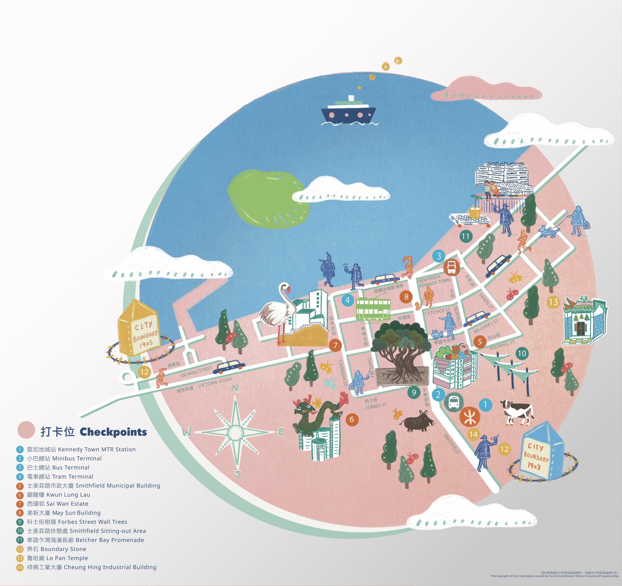
Smithfield Code Map
士美菲路解碼圖
士美菲路是堅尼地城的動脈,由維多利亞港延伸至摩星嶺,引領我們於瞬間接觸香港寶貴的藍綠資源。透過這解碼圖,我們誠邀你一起欣賞士美菲路獨特的面貌及蘊藏於其中的有趣城市演進故事:從香港島偏遠西端的河床地區至1880年代於「垃圾灣」填海而成的土地;繼而從古早的維多利亞城末端充滿厭惡性設施的一隅(如牛棚、屠房、瘟疫醫院),發展至一個蓬勃的住宅區,包含新舊建築物、食肆和藝文組織。士美菲路由城市邊陲轉化成靈感泉源,洋溢著希望及魅力。
Smithfield is an artery of Kennedy Town stretching from Victoria Harbour to Mount Davis, a reach out to the blue-green assets of Hong Kong in a glimpse. Through this Code Map, we cordially invite you to appreciate the unique characteristics and beauty of Smithfield which embraces interesting stories of urban evolution: From a riverine area in the remote west end of Hong Kong Island to a reclaimed land at “Lap Sap Wan” (Rubbish Bay) in the 1880s. Then, from a remote area in the bygone Victoria City packed with NIMBY (not-in-my-backyard) facilities (e.g. cattle depot, slaughterhouse, plague hospital compound) to a thriving residential neighbourhood comprising both old and new developments, foodies and art communities. Smithfield has transformed from city fringe to a muse filled with hopes and charm.